Capital
Gitega
Currency
Burundian Franc
Time Zone
UTC +02:00
National Anthem
Burundi Bwacu
Independence Day
July 1st 1962
Area
27,834 KM² (10,747 MI²)
Country Dialling Code
+257
Population
12,562,188 (2022)
Burundi is a country straddling Central and East Africa. It is surrounded by the United Republic of Tanzania to the east and south, the Democratic Republic of Congo to the west and Rwanda to the north. It is landlocked but has a large shore on Lake Tanganyika. Since February 4, 2019, Gitega has been designated as the political capital, while Bujumbura has become the economic capital.
With a population of around 12 million spread over an area of 27,834 km², Burundi is one of the most densely populated countries in Africa.
However, despite its small size and isolation, the country has been able to take advantage of this intermediate situation between Central and East Africa, between English-speaking and French-speaking Africa, in terms of economic, human or cultural exchanges as well as in the geopolitical balance.
The relief of Burundi is extremely varied. The country is subdivided into 5 eco-climatic regions. From West to East, there are:
i) the lowlands of the Imbo region corresponding to a collapsed ditch in the Western Rift Valley
ii) the steep region of Mumirwa
iii) the mountainous area ( Congo-Nile Crest)
iv) the central plateaus
v) the Kumoso and Bugesera depressions.
The altitude varies between 774 m on the shore of Lake Tanganyika and 2,670 m on the mountain ranges, gradually decreasing to 1,200 m in the east of the country.
The topography of Burundi is accompanied by a variation in climate depending on the altitude, hence a significant geoclimatic diversity.
Burundi’s climate is humid tropical influenced by altitude. It is characterized by an alternation of the rainy season which generally extends from October to May and the dry season which runs from June to September. The average annual air temperature decreases as the altitude increases. The highest annual average is 24.1 ° C (Imbo plain) while the lowest is 15.6 ° C (Rwegura). Average monthly maximum temperatures are highest at the end of the dry season (September-October) while average monthly minimum temperatures are lowest during the dry season.
Although the Nile, the longest river in Africa at 6,671 km, has been known for a long time, its source has remained a mystery. Until the 15th century, under the influence of Ptolemy – Greek geographer of the 2nd century – everyone thought that this source was in large snowy mountains close to the equator and that the melting snow fed the lakes located more in the north, from which came two streams whose union formed the Nile.
It was not until the 19th century that the English embarked on difficult expeditions to unravel the mystery of the sources of the Nile. The Royal Geographical Society had funded several expeditions from Zanzibar. In 1858, after 6 months of exploration, Richard Burton and John Speke discovered Lake Tanganyika. Speke later discovered another even larger lake, which he named Lake Victoria in honour of the Queen of England, and believed he had found the source of the Nile.
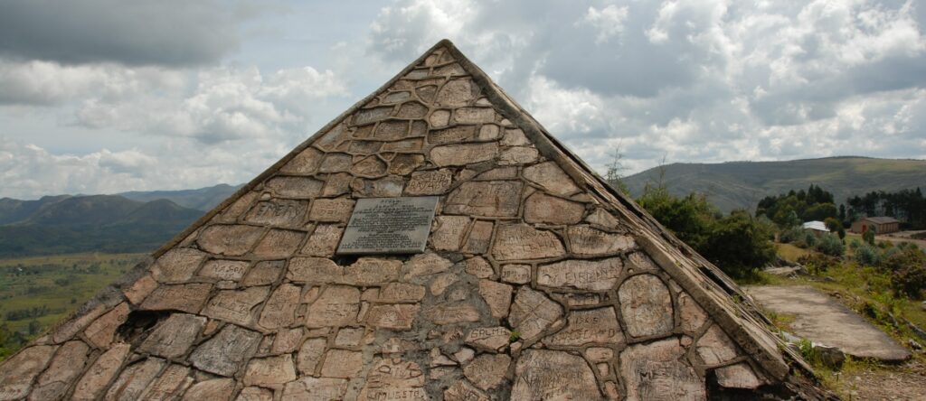
In 1860, Samuel Baker and his wife Florence discovered a river connecting Lake Victoria to Lake Albert and considered it to be the source of the Nile. Meanwhile, missionary and explorer David Livingstone claimed that Lake Tanganyika was one of the sources of the Nile. It was in 1934 that the explorer Burckhart Waldecker discovered, in the commune of Rutovu (Bururi province) Burundi, the southernmost source.
It is a trickle of water coming out of the northern flank of Mount Gikizi in the commune of Rutovu in Burundi. It continues its course by the Gasenyi and Kigira rivers, tributaries of the Ruvyironza. The latter, in turn, flows into the Ruvubu whose waters join the Nyabarongo to form the Kagera, the main tributary of Lake Victoria. The waters of Lake Victoria exit through Jinja and constitute the White Nile. Waters from Ethiopia arrive in Karthoum via the Blue Nile. From this city, the Nile is made up of a single stream and crosses Sudan and Egypt before emptying into the Mediterranean Sea.
Since 1999, there has been an intergovernmental institution called the Nile Basin Initiative created to serve as a forum for consultation and coordination between basin states for the sustainable management and development of shared waters and related resources advantageous for the 9 states: Burundi; the Democratic Republic of Congo; Egypt; Ethiopia; Kenya; Rwanda; Sudan; Tanzania; Uganda. In 2000, these countries adopted a Common Vision document with the objective of “achieving sustainable socio-economic development through equitable use and the benefit of all of the common resources of the waters of the Nile basin”. Common Vision Projects (PVC) are made up of activities aimed at promoting trust and cooperation and creating an environment that facilitates investment.
As a member of the United Nations and the African Union, Burundi naturally adheres to the goals and founding principles of both of these Organizations as set out in their respective Charters.
In addition to protecting its sovereignty, Burundi’s action is always guided by the concern for international peace and security, the promotion of human rights, friendly relations and international cooperation with a view to sustainable and equitable development.
In its vision of its relations with the other nations of the world, Burundi considers that peace, security, cooperation must start with its immediate neighbours. It is in this perspective that in 1976, only 14 years after its independence, Burundi joined forces with its neighbours from Rwanda and the Democratic Republic of Congo (then Zaire) to create the Economic Community of Land of the Great Lakes (CEPGL). According to the founding act of the Community, the Heads of State of the three countries had precisely the objectives of “consolidating the initiatives of peace, security and stability within the member countries;” ensuring the economic and social development of the three countries by intensifying trade and the free movement of people and goods and by “close” cooperation in the various fields of the national life of the three States.
Even though for several years this organization has experienced serious problems, mainly due to the many crises in the sub-region, the fact remains that its “raison d’être” remains valid.
On June 18, 2007, Burundi adhered to the Founding Treaty of the East African Community (EAC) of which it became a full member from July 1 of the same year. The other members are Kenya, Uganda, Rwanda, Tanzania and South Sudan. Incidentally, Burundi is also part of the Economic Community of Central African States (ECCAS) and the Common Market of Eastern and Southern Africa (COMESA). Created in December 1994 to replace the former ZEP (preferential trading area) which had existed since 1981, COMESA today unites 21 member states and has more than 540 million inhabitants.
As for ECCAS, it dates from October 1983 but its General Secretariat was not set up until January 1985. In addition to Burundi, the other member states are: Cameroon; the Central African Republic; the Congo; Gabon; Equatorial Guinea; DR Congo; Rwanda; Sao Tome & Principe; and Chad.
Burundi is one of the major troop contributors to peacekeeping operations. The largest contingent has been deployed to Somalia since 2007 as part of AMISOM (African Mission in Somalia). Despite the inevitable losses in these types of operations, on the ground, the Burundian soldiers are highly appreciated for their courage, bravery, and discipline, qualities which make them veritable guarantors of the peace and security of the Somali populations who are plagued by repeated attacks from Islamist Shebabs.
Within the framework of the United Nations, Burundi contributes to peacekeeping operations with a little over a thousand personnel distributed mainly within MINUSCA in the Central African Republic and in MINUSMA in Mali. Finally, during the crises in Darfur, Côte d’Ivoire or Haiti, Burundi made its soldiers and police available to the United Nations in order to restore peace and security in those countries.